
One of these is Machine Cross, on the A396, Dunster to Tiverton road, on a staggered crossroad providing a main turning into Dulverton across Hele bridge. Hilary Binding consulted the earliest maps, contacted local parish councillors and spoke to nearby residents for clues.
One theory is that it is named after the nearby Machine Court, the site of a mill with a leat still identifiable from the River Exe, including a Machine Barn, which perhaps stored some significant agricultural machinery. Another idea arises from the local name for the road running up to the junction, Machine Steep. According to an eighty year old local resident, the turnpike road, which preceeded the A369, was built higher than the level of its adjoining roads, requiring a ramp to allow heavy farm machinery such as traction engines to get up onto the road.
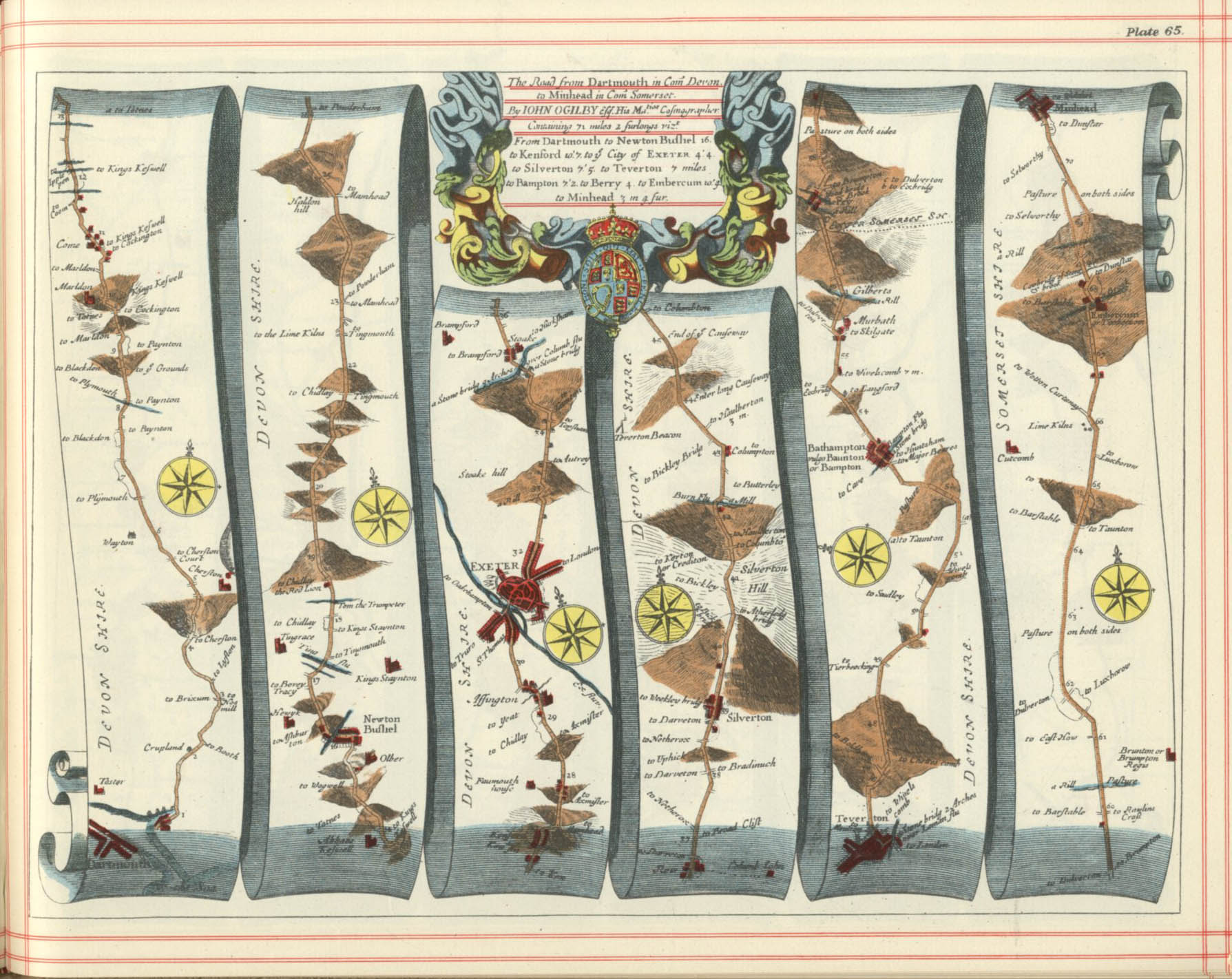
The crossroads at Machine Cross is very old, appearing on the earliest road map of England, John Ogilby’s Britannia published in 1675, and actually much older than that. One of the one hundred road routes featured on scroll-like diagrams was from Dartmouth to Minehead, via Tiverton and the crossroads at Machine Cross.
The Ogilby Map is at https://fulltable.com/vts/m/map/ogilby/d/SH015.jpg


